Maps
Maps
Shop for
Your Wall Maps
Your Wall Maps
Paper
Laminated
Wooden Rails
Plastic Rails
Mounted
Basic Framed
Executive Framed
Magnetic
Map ReStickers
Map Add-Ons

Our Publishers


Wall Maps for
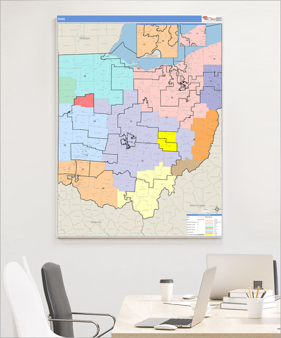
Government
The US government uses custom wall maps from mapsales.com for many purposes including lobbying, elections and social security.
Features Commonly Used on
Government Wall Maps
Government Wall Maps
Points of Interest
Drive Time Polygons
Laminated
Police & Fire Departments
Hospitals
Government Centers
Schools
Street Level DetailHospitals
Government Centers
Schools
Evacuation Routes
Highways
All Streets
Waterways
Border Crossings
Up-to-Date and Accurate Levels of GeographyHighways
All Streets
Waterways
Border Crossings
Congressional Districts
Residential & Commercial Zoning Boundaries
Government Jurisdiction Boundaries
School District Boundaries
ZIP Code Boundaries
County Boundaries
State Boundaries
Custom Boundaries and Territories
DemographicsResidential & Commercial Zoning Boundaries
Government Jurisdiction Boundaries
School District Boundaries
ZIP Code Boundaries
County Boundaries
State Boundaries
Custom Boundaries and Territories
Population, Gender, Age, Income, etc.
Thematic Shading and Counts
Radius RingsThematic Shading and Counts
Drive Time Polygons
Laminated
Draw, write and erase directly on maps
Custom Colors and Themes
Formats

Wall Maps
2x3 to 9x12 feet and larger
Laminated, Framed, Magnetic and more
Custom sizing available
Printed MapsLaminated, Framed, Magnetic and more
Custom sizing available
8.5x11 to 17x22 inches
Custom sizing available
Custom sizing available
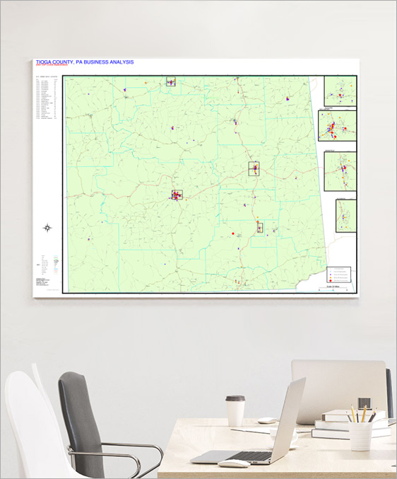
Tioga County Business Analysis